Up next in 10


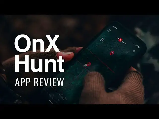
This video is about the OnX Hunt app, reviewing the features and benefits, and who it may be a good fit for. Simon has been experimenting with the app this hunting season, and has some pointers to share.
Learn more and buy: https://www.onxmaps.com/hunt/app
In this video:
0:00 - Why I got the app
1:04 - What is the OnX app?
3:50 - How to scout with OnX
4:55 - OnX features
11:25 - My favorite feature
13:22 - How much it costs
Brought to you by LakeHub. We are sharing the joy of lake life! Learn more at https://LakeHub.com
Show More Show Less View Video Transcript
0:00
What's up everybody? It's Simon from Lake Hub. This year, I started using OnX hunting app for the first time, and I want to share my experience with you
0:10
Now, what I used this app for was mainly for exploring new areas. So that's going to be the experience that I'm going to share
0:20
I'm going to share some of the features that I really, really like, some of the features that were semi-useful to me
0:26
and what I would use this app for and what I wouldn't use this app for so that you can
0:33
decide whether this app is right for you. First of all, I have to say what a time we live in
0:43
All this information that used to just take hundreds of hours at county clerk offices
0:50
to determine is now right at the fingertips of a guy like me
0:56
Come on. That's awesome. I have to say how awesome that is. Okay, so what is the OnX hunting app? It's an app to explore new areas, to explore terrain. It allows you to do like 2D maps, satellite view, topographic maps, property lines. And then that's kind of the first package field
1:26
of the app is being able to scout areas that you're not actually boots on the ground at
1:34
And then the second is recording historical data. So you can mark your hunting spots
1:41
You can mark trails. You can mark sign. There's all kinds of stuff that you can mark
1:49
Trailheads, you know, actual defiant trailheads, parking areas on and on and on
1:54
any sort of landmark that you want to create, you can mark it and save it and categorize them
2:00
into different, different, you know, many libraries, basically. So those are the two main reasons
2:06
that people use this app is for the information that it provides you and then the information
2:14
that you provide yourself for your future you. To give you a little background on myself
2:20
I use this for deer hunting and there's a deer leaf. that I'm a part of, I've been hunting this property a long time over a decade, know it pretty
2:30
well. So I didn't use it for the marking and the signs and all that kind of stuff
2:36
I know where all the trails are that matter. I've explored this property a lot. And so all that
2:45
is already up here. Now, if you want to put it, you know, if you're a tech nerd and you just
2:50
want to put it in here so that you have it and it's fun to have and it's fun to keep trying to
2:54
of stuff, totally get that. Do that if that's what your thing is. That's not for me. What I wanted
3:01
this for, the reason why I jumped on board, had a couple of recommendations, good referrals to
3:08
try this app out this year, was I was exploring new properties. You can check out my Texas drawn hunts
3:15
videos. I got selected for a couple of drawn hunts. And so I was going totally blind onto public
3:22
land. One of them I had a couple days. I had like three days ahead of time to scout my area. I got
3:28
my assigned compartment and I was able to use this app and scout. The other one, it was totally
3:34
on the fly. I didn't know what I got until I got there. And then I was really, really thankful
3:40
for my favorite feature which is share at the end, which really, really came in handy in a low
3:46
signal area. Now, how did I scout? I'm going to go to the desktop here because I really encourage you to get off the phone
3:58
Use the phone for when you in the field Use the phone app But they have a desktop app that is really really useful and it the best way to explore properties that you never been to get on a desktop get the biggest baddest
4:13
monitor that you can and go exploring this is the way of the use that you can really really see it
4:18
so let's switch to my screen here now i'm going to show you an area that i actually hunted so up
4:25
here you can see dallas you can see fort worth there's richmond chambers reservoir right in the
4:29
middle. There's a couple of wildlife management areas that are huntable in different circumstances
4:36
One is right below the dam here and the other one's over here. This is one that I actually hunted
4:42
And you could see, now we're starting to see, okay, you can kind of take a look and say
4:46
okay, this is all probably open public land here in the middle because it's pretty wild and then you
4:51
have like kind of managed farmlands and stuff around it. So one of the great features is being able to
4:57
turn these layers on and off. So I'm going to turn on private lands. You can see all the property
5:03
lines here. I'll zoom in. You can actually see the names of the ownerships that are on the record
5:07
with the county. And then just for example, I'm going to turn on Texas government lands. So you can
5:15
add all these layers. They have these libraries of layers that you can add. And so I've got kind of my
5:21
the ones that I added that I think that I would use. Here's how I actually use these layers. What
5:27
would do is I would turn on the Texas government lands so I can get an idea of where the outlines are
5:34
like this and then I would actually just turn the private lands on, turn the government land off
5:40
so that there wasn't any overlay and I can really see the details and then just make sure that I'm
5:45
aware of where the private property lines. What I thought when I was adding all these layers to my
5:51
library was that I was going to use the Texas government lands and turn that on and then
5:57
explore in there. But the way it's set up, it actually was more useful to turn that off when I'm
6:04
exploring and turn on private lands and explore within the boundaries. So let's go back to the
6:09
screen here. Here I've got it set on 2D mode and satellite. So I'll show you what a few of these
6:15
things look like. Here's a topal map, which I love a good topal map. I just love exploring topal
6:21
maps. I think they're the coolest thing ever. Whoever first thought of that method for a map
6:27
mapping geography is just brilliant. I love it. So handy, so cool looking. I love, love, love
6:35
a good topal map. So here is, you can see the kind of marshland. So this is all kind of a
6:42
soggy bottom land. You can see where the ridges are. There's ridges here. Ridge is here. And
6:48
the bottom land here in the middle where the creek is, obviously. There's also a peak
6:53
There's also a peak at 350 feet, 450 feet. So there's a couple good little little hills in this terrain here
7:00
So what I found handy was using this hybrid mode right here in the middle where I have
7:05
the Topal lines and then I have the satellite too. So you can actually see what's going on
7:12
You can see where the open spaces are. You can see where the roads are for access. There are some overlays and these are these double dash lines for roads
7:22
I found those to be somewhat useful. I'll give you an example
7:28
This does not go all the way to the river. And this right here becomes like a single track
7:36
Like this is a road right here. And then this is a cut line for power lines
7:42
And right down south towards here, this is almost impassable. It's almost completely impassable
7:47
So in the app, it looks like a road. And I ran across that a couple times
7:52
Some of these are very clear, clear, well-maintained roads. and some of these are probably really, really old
8:00
So I'm not exactly sure what the deal is with the double-dashed lines for roads
8:05
but it was really hit and miss So don count on those being really really good access especially if you planning on driving them
8:15
So then what I would do is switch to 3D mode. This is really cool and this is only available
8:22
on the desktop version. So if you're on the website, that's onxmaps.com
8:27
and you're actually in their web map. You go, you know, log in and then go to your map
8:32
and all that kind of stuff. Then you can actually use this 3D mode. I'm on Apple, so I'm using control to click and drag
8:41
And you can turn around. You can reorient. And then you can start to see, you know, the curves of the land
8:47
Of course, we're in the prairie land here. So things are pretty flat compared to out west
8:52
But you can see some of the subtleties. You can, and what I found helpful was the topo lines just because this area is so flat and subtle
9:04
as far as the slopes and the terrain and everything like that
9:09
Here's the actual property where I was. I was able to use these top of lines and understand, okay, this metal right here, this is a pretty good spot
9:20
It's right next to private land. It's right next to a hayfield. It's on top of a ridge
9:26
There's access, there's clear access from these power lines right here. And there's water down here
9:34
So this might be a good kind of travel course. This might be a good travel course
9:40
Right here, there were trails all up and down here. So I knew where the deer were moving
9:46
and I was able to discern that and find this meadow right here
9:51
which turned out to be a good little spot. So did this power line. Here's the gate off the road, so I was able to find my access
9:59
And this was how I was able to scout the land, and then also determine, hey, this creek bottom right here, this is really marshy, this is really thick, this is underbrush, it's a good place for hogs, not a great place for deer, and I was right about that once I put boots on the ground
10:16
So you can see that the power in this 3D view for scouting, being able to see the property lines, being able to see the contours of the land, see all the features, the open spots, and to create all
10:32
opportunities for yourself so that you're educated when you get out in the field, you know you've got
10:38
a head start, you've got a lot of intel, and you're going to go check these places out. Some of these
10:42
are going to be busts. They just don't look the same, you know, when your boots on the ground as they
10:47
do from the air. That just happens. But you're armed with, you know, maybe a few spots to check out
10:54
Maybe you have three or five spots that you think are possible to be a good hunting area
11:00
maybe even as much as 10 or 12 spots that you think are possible to be good hunting areas
11:05
you can mark them, you can add waypoints on the desktop version
11:11
You can actually do all your scouting and homework on your desktop or laptop
11:16
Then when you go to your phone, it's all there and all your waypoints are there. Now I'll tell you what my favorite feature is for this app
11:26
especially for hunting really rural areas, is that on your phone, even though you don't have the 3d version of the of the map which I was a little bit
11:34
disappointed with once I but I was only disappointed with it because I found it so
11:40
useful on the desktop version my favorite feature is that you can download an
11:45
offline map you can do a five mile five square mile area ten square mile area and you
11:53
can actually download the data of that entire map onto your phone into the software
12:00
and then you can turn your phone offline. I usually hunt with my phone in airplane mode
12:07
Then make sure that nothing buzzes, nothing rings. If I in a low cell area in the first place then that makes sure that my phone battery lasts as long as possible because it not searching for signal and searching for signal searching for signal
12:23
So turn everything off, conserve battery. Of course, I've got backup battery power in my pack just because that's your emergency line
12:35
you know, if you need it. But that way, I was able to use the message
12:40
maps I was able to pull them up when I needed them and use everything in offline mode I had
12:47
everything at my fingertips it's using your GPS it's kind of interesting because you know once
12:53
you get into I don't know maybe a 30 yard area in your screen you know your location is kind of
13:01
doing this as the satellite you know is kind of readjusting itself to stay in position over
13:07
the earth it's it's pretty cool it's pretty amazing how fast real time detailed information we can get to our fingertips it's incredible what a time to be
13:19
alive what a time to be a hunter so that feature alone to me was worth the money what did I spend
13:26
I had the premium uh membership that was 2999 so I decided to bite the bullet
13:35
spend you know spend $30 and see if it was good for me if I'm going to use it a lot then I'll
13:42
re-up next year if I'm going to be exploring new areas I'll re-up next year if not if I'm just
13:47
hunting the areas that I'm used to and I probably won't to be honest but if I'm out
13:52
exploring new areas and I'm doing it a lot then yeah 30 bucks well worth all of
13:59
this information well worth all this information well worth the scouting ability alone
14:05
You're going to save yourself so much time. You spend all this time and energy and money to go on to a hunting trip
14:13
And then once you get out there, the last thing you want to do is step onto the grounds with zero intel
14:21
Save yourself a lot of time, maximize your hunt and put as much in your brain and in your pocket as you can before you go
14:29
30 bucks, well worth it. Now, here's where they get you. if you want to go outside of one state, now we're talking about 100 bucks a year
14:42
Okay. But once again, if you're planning a big time hunt to the Rockies, if you're going up to Montana
14:49
or out west or back east or whatever, whatever your hunting trip is, you're spending money
14:57
on travel. You might be spending money on a guide. You might be spending money on tags
15:03
You might be spending hundreds of dollars on tags. even thousands of dollars on tags, you're going to be spending a lot of money to go have fun
15:11
Arm yourself with Intel. If you're doing all that, 100 bucks is worth it
15:15
It's not worth it to me because I don't do that. But a lot of people that I know do, and if you're going to be out in the back country
15:23
if you're going to be out in national forests and you're going to be, you know
15:28
pounding the ground for days, for days looking for critters, then that's going to be
15:35
really worth the money for you. So that's my review of on X map
15:39
If you're going out and exploring new territory, I really, really recommend trying it
15:45
and seeing if it's right for you. Try the premium membership. Try it out like I did
15:50
See if it's right for you. If you hunt the same property every year
15:54
and you know that property like the back of your hand, I don't think this app is for you
16:00
If you are exploring backcountry and you're bushwhacking and you're doing all that kind of fun stuff
16:04
then this will really come in handy. Save yourself some time in the field
16:11
maximize your hunt, plan ahead, get out there, folks, be safe, and bag something
16:17
I'm Simon from Leikud. We'll catch you next time
#Outdoors
#Hunting & Shooting